
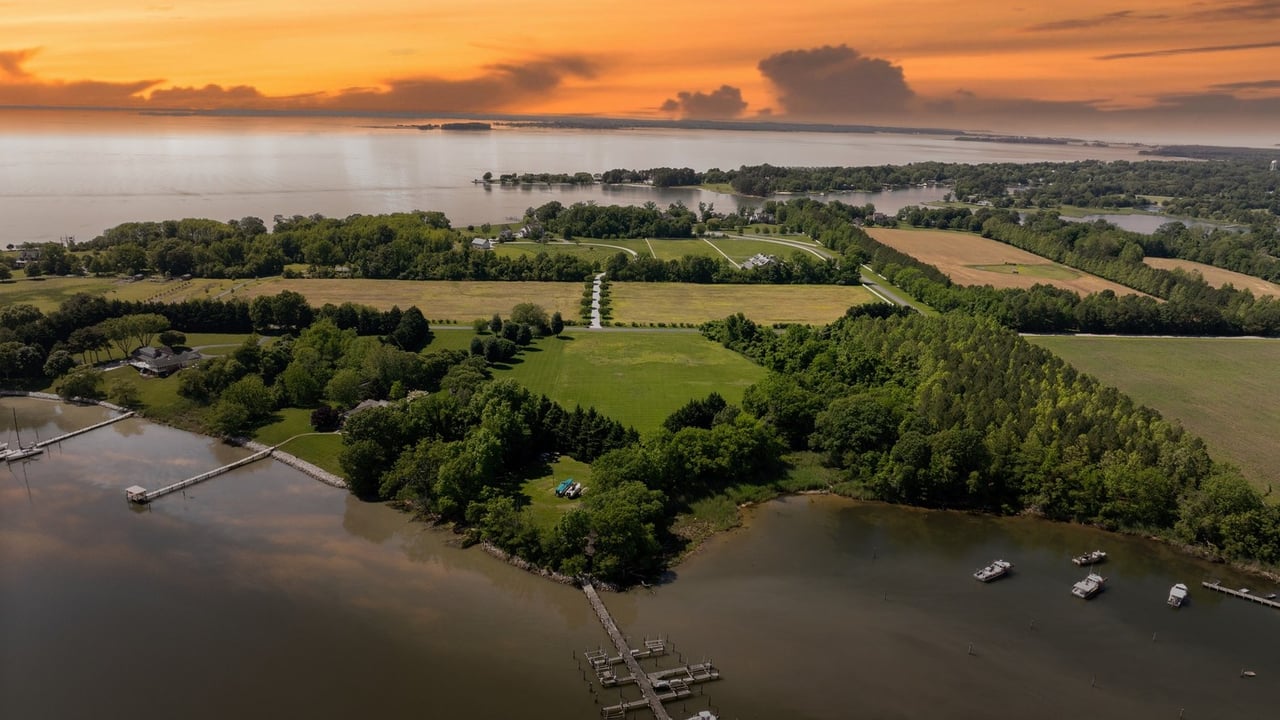
You can see the house before it exists. A porch facing the water. A kitchen open to the view. Somewhere to leave wet towels after a day outside.
Then the practical questions arrive. Where can the house sit? Is there room for the driveway, septic system, and outdoor spaces? Can the old cottage be replaced? What about the trees between you and the water?
Building on Maryland waterfront starts with understanding what the whole property can support—not simply choosing a house that looks right beside the Bay. The Critical Area rules are part of that answer, but they are not the only part.
That does not make the dream unrealistic. It changes the order of the work. Establish the limits, investigate the possibilities, and design a home that belongs on the site. The expensive mistake is buying first and discovering later that your nonnegotiable feature was never a supported assumption.
The Critical Area, the Buffer, and the Floodplain Are Different Things
Maryland's Critical Area generally includes land within 1,000 feet of tidal waters and tidal wetlands, along with the tidal waters and underlying lands. The program covers the Chesapeake Bay, Atlantic Coastal Bays, and their tidal tributaries. You do not need a private pier—or even direct shoreline frontage—for a property to be affected.
The Buffer is a more tightly protected area beside tidal water, tidal wetlands, and tributary streams within the program. It is not another name for that entire 1,000-foot area. A floodplain designation addresses a different set of flood-hazard and development questions. Passing one review does not settle the others.
Start with the state's Critical Area mapping resources and the responsible local planning office. Confirm which adopted maps and site conditions apply. An online map is a screening tool, not the survey and field work needed to position a house.
An inland lake or a nontidal stream is not automatically governed by the tidal Critical Area program. It may still involve other environmental, floodplain, or local restrictions. Begin with the actual waterbody and parcel rather than the word “waterfront.”
Three Letters Help Explain the Review
The state describes three Critical Area land classifications:
Intensely Developed Areas (IDAs) are places with concentrated development. Water-quality improvements and stormwater treatment are central concerns.
Limited Development Areas (LDAs) combine lower-intensity development with natural habitat. Coverage, woodland protection, and runoff are among the controls.
Resource Conservation Areas (RCAs) emphasize natural landscapes and resource-related uses. The general residential density is one dwelling per 20 acres, but that is a density standard—not a rule that every existing residential lot must contain 20 acres.
Older lots, local zoning, and applicable approvals still need review. None of these classifications should be read as either “you can build anything” or “you cannot build at all.” Ask what it means for the specific project you have in mind.
Find the Real Buffer Before Drawing the House
The familiar “100-foot rule” is a starting point, not a complete site plan. Maryland's Buffer regulation generally requires a minimum 100-foot Buffer measured from the mean high-water line, the landward edge of tidal wetlands, or the banks of a tributary stream. Sensitive soils, wetlands, and steep slopes can require expansion.
Certain RCA subdivisions and site plans receiving final local approval on or after July 1, 2008 require at least a 200-foot tidal Buffer, with specified exceptions and possible additional expansion. The relevant boundary may therefore be substantially different from a line drawn 100 feet back from the visible water.
New disturbance in the Buffer is generally prohibited except through the authorizations the regulation allows, such as qualifying water-dependent work or a variance.
Some developed locations have an approved modified-buffer designation. Anne Arundel's Buffer Modification Areas, for example, have particular development criteria. “Modified” is not the same as unregulated.
Ask a qualified surveyor and environmental professional to identify the relevant site features and have the reviewing authority confirm how the rules apply. The question is not where an attractive rectangle fits on an aerial photograph. It is where a supported design can fit on the land.
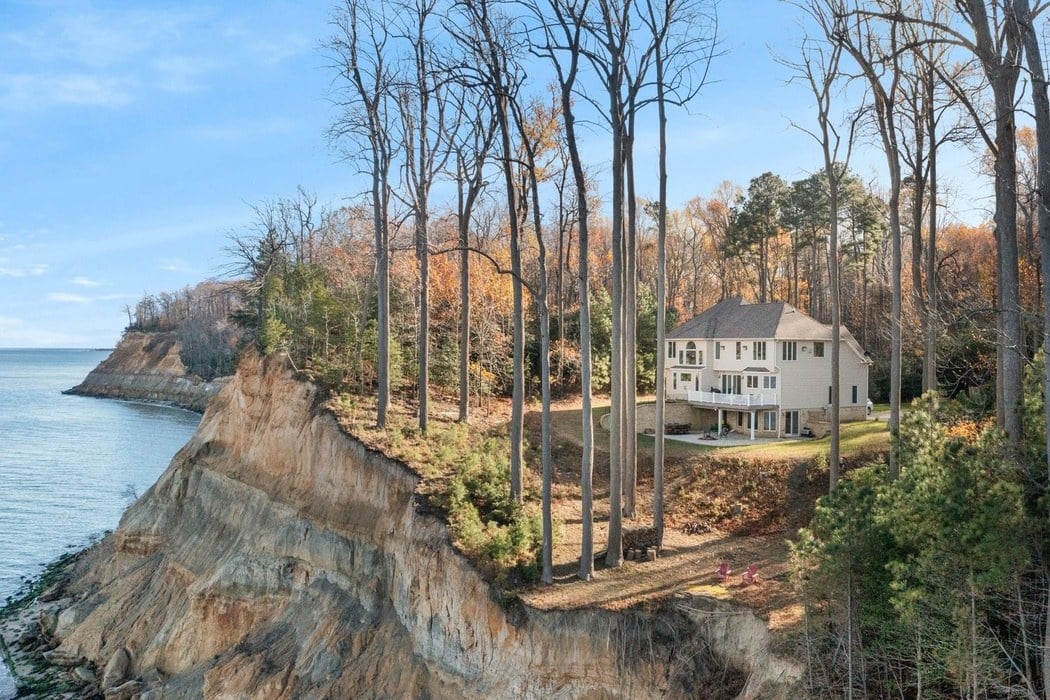
The House Is Only One Claim on the Site
Put the entire wish list on one concept plan: the house, garage, driveway, parking, decks, pool, utilities, drainage, well, septic facilities, replacement area, and route to the shoreline. Add the easements, setbacks, vegetation, and other constraints identified by the project team.
Anne Arundel's single-family permit requirements call for site information that includes property lines, easements, rights-of-way, and relevant well and septic features. That is a useful way to think about feasibility even before a formal application.
Our view: evaluate the complete version of waterfront living you intend to buy. A lot that accommodates the house but cannot support another essential part of the plan may be the wrong lot—not necessarily a problem that a different floor plan will solve.
Lot Coverage Is Not Just the Roof
Critical Area lot coverage includes more than buildings: driveways, parking, walkways, gravel, pavers, and permeable pavement can count. It is also distinct from a zoning calculation for coverage by structures.
State law generally limits LDA and RCA lot coverage to 15%, with important exceptions. For example, qualifying Chesapeake Bay lots of one-half acre or less that existed on or before December 1, 1985 have a 25% limit; the Atlantic Coastal Bays provision uses a different date. Additional allowances have conditions.
Have the local reviewer confirm the applicable calculation and legally established existing coverage. Do not treat gravel as free square footage or assume removing one feature automatically authorizes another somewhere else.
For illustration, a broad arrival court and a pool terrace may compete for the same coverage allowance. Resolving that trade-off before designing either is more useful than discovering it after paying for both designs.
The Buffer Is Part of the Property's Value—not Leftover Space
The Buffer's environmental role includes filtering runoff, protecting habitat, and helping stabilize shorelines and slopes. Those functions are connected to the water and setting that make the property appealing.
Think of it as a living part of the site rather than a strip waiting to become lawn. DNR explains that healthy Buffer vegetation cannot be removed solely to create a view. Carefully planned pruning and planting can offer alternatives, subject to the applicable approvals.
Make the view conversation part of the design from the beginning. Which outlook matters from the kitchen? Where would you sit? What can be framed through existing vegetation? “We'll clear it later” is not a design strategy.
Work Outside the Buffer Can Still Create a Planting Obligation
This is an easily missed distinction. Buffer-establishment rules can apply to development outside the Buffer on a lot that contains one. Required planting depends on factors including the project category, lot history, and existing vegetation. The regulation excludes in-kind replacement from that particular establishment requirement.
That means a house positioned outside the protected strip may still require a vegetation plan within it. Ask early what the completed landscape must look like, who installs it, and what maintenance follows.
Buffer Management Plans must be approved before the covered development approvals are issued. Their planting, protection, and maintenance requirements are part of the project—not optional landscaping after move-in. Maintenance of an existing lawn or garden is treated separately from a new development proposal.
An Existing Cottage Is Not a Blank Check to Rebuild
A waterfront house already standing in a constrained location can look like a shortcut. Sometimes it offers a workable starting point. The necessary question is what its documented status allows you to do next.
Maryland's grandfathering provisions distinguish continuing an existing use from intensifying or expanding it. Certain older lots receive density-related treatment, but other development requirements remain. Grandfathering is not a blanket exemption from Buffer or water-dependent-facility rules.
Ask for the permit history, approved plans, prior variances and conditions, evidence of lawful improvements, and any unresolved violations. Have the local authority explain how renovation, an addition, replacement, or demolition would be treated for your proposal.
Do not remove the existing structure before establishing the replacement path. That is our practical recommendation, not a claim that demolition always eliminates a particular right. The point is to avoid making an irreversible decision while relying on an unverified assumption.
A Variance Is an Application to Prove—not an Upgrade to Purchase
Critical Area variance standards require evidence and written findings addressing unwarranted hardship, site-specific circumstances, water quality, habitat, and other criteria. The request cannot rest on a neighboring property's condition or circumstances created by the applicant.
A neighbor's pool, deck, or house position therefore does not establish what you can obtain. Bring a land-use attorney and the appropriate design professionals into the discussion when the project depends on relief. Evaluate an approvable alternative rather than making success depend entirely on the preferred exception.
The Unseen Systems Can Decide the Layout
Confirm public water and sewer availability with the provider rather than assuming nearby service means a connection is available. For private systems, request the records and ask the health department what the intended home requires—including proposed bedrooms, replacement capacity, and space that must remain available.
In Anne Arundel, some properties can be evaluated only during wet-season testing. Missing the relevant testing opportunity is a different problem from waiting for a contractor. Build feasibility into the schedule before accepting a construction start date.
Also investigate nitrogen-reducing treatment. The county's Critical Area guidance describes Best Available Technology, or BAT, requirements for covered septic permits. It also requires operation and maintenance through a certified provider for the system's life, with service and inspection at least annually.
Ask what applies to your system and proposal. The budget needs to include both installation and the ongoing obligation, not simply the equipment shown on the plan.
The House, the Shoreline, and the Pier Are Separate Projects
A house permit should not be read as permission to rebuild a bulkhead, extend a pier, add a lift, or dredge a channel. Those elements need their own investigation.
MDE's tidal-wetlands process addresses work in tidal waters and wetlands. Establish which state authorizations, local approvals, and federal reviews apply to the proposed work before pricing it as a settled part of the purchase.
Start the Erosion Conversation With the Shoreline That Fits
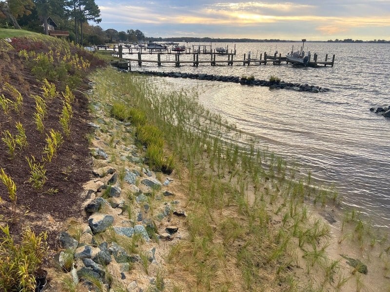
Maryland's living-shoreline requirements generally call for marsh creation or other nonstructural stabilization unless a waiver is obtained. Site suitability matters, and MDE identifies conditions under which a structural approach may qualify for a waiver.
Do not start by assuming that a new bulkhead is either required or automatically available. Ask a qualified shoreline professional to evaluate the site, alternatives, necessary authorizations, and access for construction. A design must fit the exposure and conditions—not just your preferred appearance.
Ownership, Permission, and Boat Use Need Separate Answers
St. Mary's County's waterfront-development guidance describes both state and county authorizations and the joint federal/state application process. It also identifies the applicant's riparian interest—the relevant waterfront property rights—as part of the application.
Have the title professional or attorney confirm the rights and restrictions involved. Request the existing pier's approvals and compare them with what is actually there. Then separately investigate whether the permitted configuration, water depth, and route to open water serve the boat you intend to use.
Those questions belong before closing when boating is central to the purchase. A pier visible in a photograph answers none of them conclusively.
Floodplain Rules Can Change a Renovation's Scope
A Critical Area-compliant plan still needs any applicable floodplain review. For an existing house, the renovation budget itself can become relevant.
Calvert County's published floodplain ordinance, for example, defines substantial improvement using a cost threshold of 50% of the structure's market value, excluding land, with specified qualifications. Substantial damage is a related but separate determination.
Ask the local floodplain official how the current rules apply: which valuation is used, which costs count, whether cumulative-work provisions matter, and what compliance work would be triggered. Do not use the entire waterfront purchase price as the denominator or assume staging work into smaller contracts resolves the issue.
The ordinance also warns that permitted construction is not a promise against flooding. Obtain property-specific insurance advice and an engineering assessment of the proposed home and site. Think about equipment placement, access during high water, and the responsibilities of owning the finished property—not only whether a design can receive a permit.
Build an Approval Map, Not a Stack of Assurances
Start with the local Critical Area contact for the property's jurisdiction. Assemble a clear project description and ask who needs to review each part.
Your working list may include local planning and building staff, health officials, MDE, the U.S. Army Corps of Engineers, utility providers, and a homeowners association. Assign someone to resolve each applicable question. Keep private covenants and access rights separate from government approvals.
For every document, record what it authorizes, its conditions, its status, and any expiration or transfer question. Distinguish an informal conversation, a favorable preliminary comment, an approved plan, and an issued permit.
A preliminary meeting can save time by identifying problems. Treat it as that—not as permission to start work or assurance that the finished application will be approved.
Construction Access Belongs on the Plan
The Buffer regulations include temporary disturbance, such as material storage and construction access routes, as well as permanent work. A compact finished house does not necessarily mean a compact construction operation.
Ask where equipment will travel, where materials will sit, and how the protected areas will be kept out of the work zone. Coordinate that with the contractor before approvals are treated as complete.
A Better Sequence Before You Commit
We would organize a waterfront building search around five decisions:
- Define the essential outcome. Identify the house, outdoor spaces, access, and waterfront use that make the purchase worthwhile. Separate essentials from features you could trade.
- Collect the property record. Request surveys, plats, easements, permits, conditions, well and septic records, shoreline approvals, and any violation history.
- Test a complete concept. Have the appropriate professionals place the proposal and constraints on one plan. Establish the remaining questions with the reviewing authorities.
- Price the supported scope. Obtain project-specific proposals and identify contingencies, unresolved approvals, planting obligations, and ongoing maintenance.
- Commit with the uncertainty visible. Work with your agent and attorney on access for investigations, deadlines, contingencies, and what must be established before the purchase or next major expenditure.
Do not treat a short inspection period as an environmental approval schedule. Decide which evidence you need at each stage and what risk you are prepared to accept if an answer remains outstanding.
For the wider purchase process, the Housecats Homebuyer Roadmap connects preparation with the search, offer, and closing.
Budget for the Waterfront Project—not a Generic Waterfront Surcharge
Ask the team to price surveys, environmental work, design revisions, drainage, utilities, permit applications, any variance process, shoreline work, planting, construction access, and required monitoring where relevant. Identify what is included in the builder's proposal and what you must arrange separately.
Keep a reserve for the actual unresolved risks. A site still awaiting septic feasibility and a property with a reviewed concept and documented utility connections should not receive identical assumptions simply because both are waterfront.
There is no universal cost premium or permitting duration in this guide. The useful comparison is between documented scopes: what you can do, what remains contingent, what it costs, and whether the resulting home still fulfills the reason for buying.
Design for the Waterfront You Want to Keep
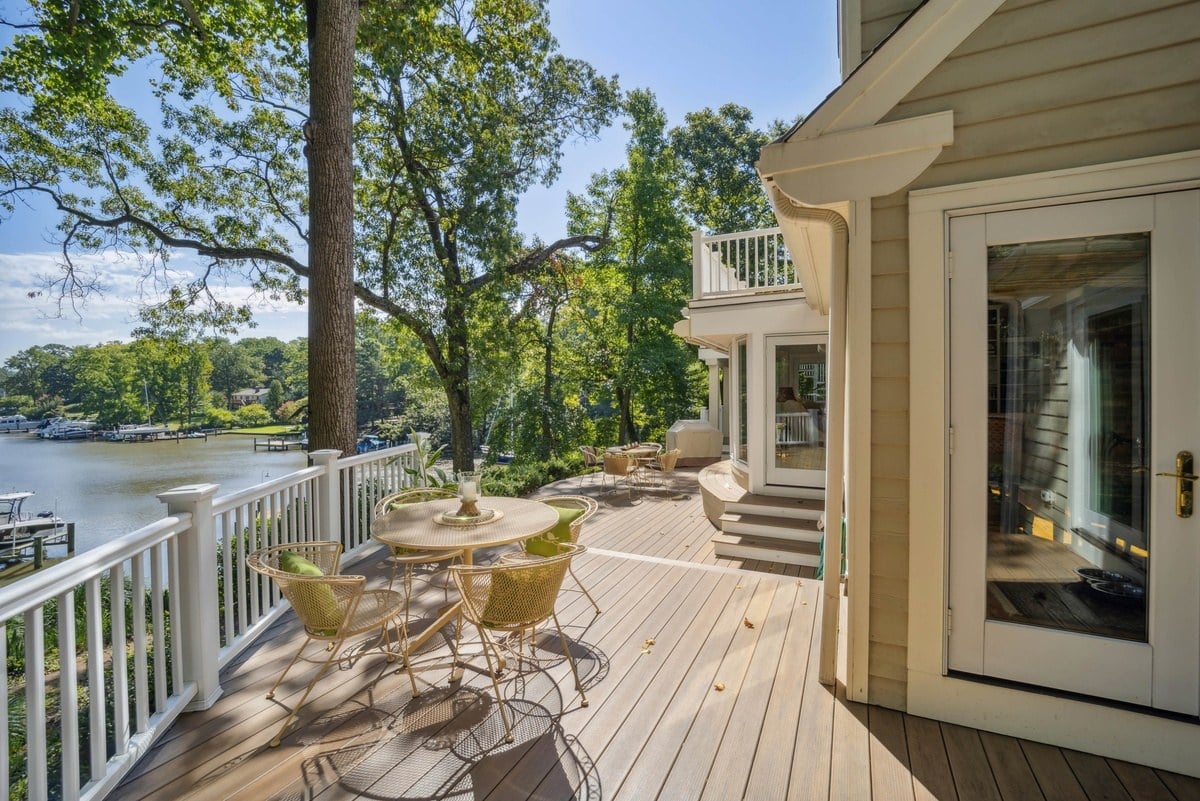
The best waterfront plan is not necessarily the one that uses every available square foot. It is the one where the house, access, outdoor life, and natural setting work together.
A more focused driveway may leave room for the outdoor space you will use daily. A carefully placed room may frame the view without requiring the landscape to disappear. Those are design questions worth exploring, not predetermined answers for every property.
Keep watching the requirements confirmed for the site, the approvals actually issued, and the costs still unresolved. Revise the plan when the evidence changes, not after construction has made the choice for you.
You are not only choosing where to build. You are choosing the waterfront experience you want to live with—and care for.
Call (410) 991-1382 to talk through your Maryland waterfront search. Start with the property and the possibilities, then bring the right professionals into the plan.
Research reviewed September 21, 2026. This is general planning information, not a parcel-specific building determination or legal, engineering, environmental, insurance, or lending advice. State standards, local programs, exceptions, and prior approvals must be evaluated for the actual project. Photographs from the Housecats guide library are illustrative; they do not establish location, condition, regulatory compliance, or current availability.